
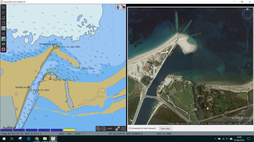
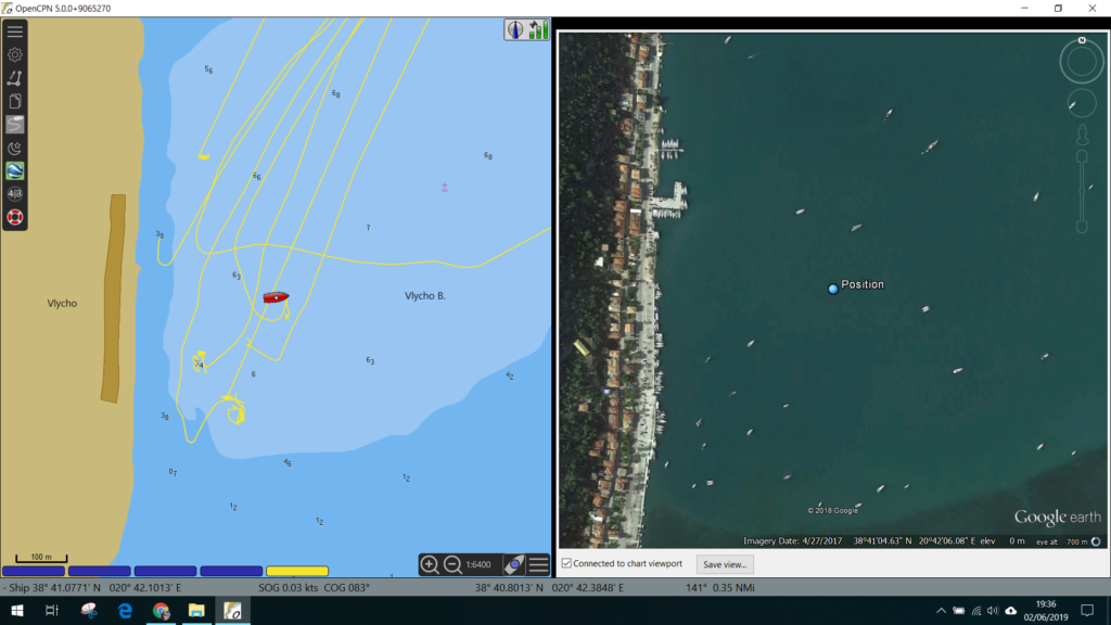
Mirroring a Google Earth image next to your OpenCPN charts whatever they may be, is a hugely beneficial FREE feature!
As you can see from the images here which I took whilst using my C-Map Charts alongside the latest Google Earth images, there is quite a discrepancy, admittedly my charts are from 2011, but you get the point!

Google Earth in OpenCPN Google Earth in OpenCPN Google Earth in OpenCPN

In fairness on my own boat I am using Navionics on a tablet to navigate, and this is a backup but on some vessels I use OpenCPN with the fantastic O-Charts which are great value, although they only cover some countries.
Anyway, back to Google Earth, for this example I am using OpenCPN 5.0.0. on Win 10 PC. Simply follow these procedures and you should be up and running:
- Download Google Earth OLD version Google Earth 7.0.2.8415 23Mb
- Download the Google Earth Plugin Setup package 0.3Mb
- Install both
- Activate the Google Earth plugin in Open CPN options (see below)
- Press the Google Earth button that is now on your menu
- The Google Earth should appear as a small box, which you can then drag to the right or left of the screen, and then resize the vertical bar between the two screens.
- You can adjust the size of the cache in Google Earths program, default is 2000Mb which means that when you have visited somewhere whilst online, it should still be available when you are offline 🙂
- That’s it! I hope it works well for you, and let me know any comments / findings below. I can’t offer support, but the community might 🙂
